
-
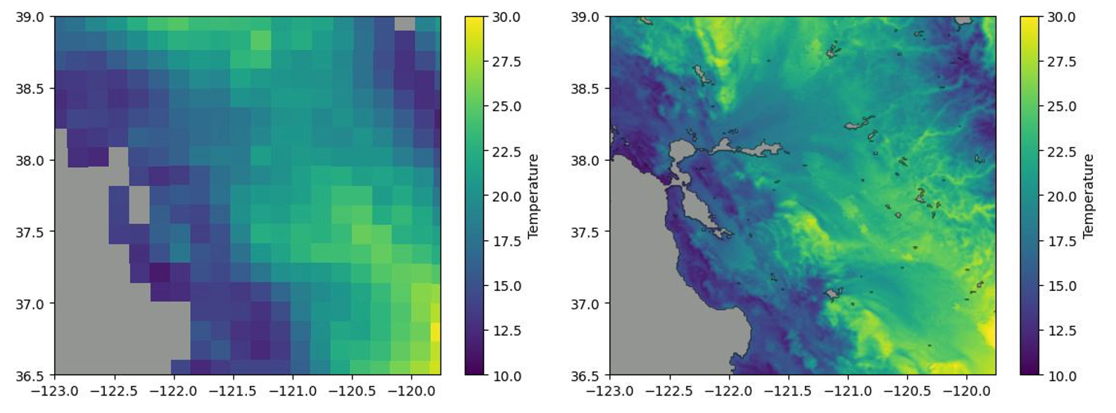
Bias adjustment. The CMIP ensemble has a significant bias that makes it wildly inaccurate. We refine the data and make climate predictions much more precise, similar to how Meteum corrects its 10-day forecasts on the fly. However, the scale is much larger when it comes to long-term predictions.
-
Downscaling. As a climate model, CMIP “sees” the Earth as a gigantic grid composed of pieces with a resolution of 100 by 100 km (62 by 62 mi). Using machine learning, Meteum can increase the resolution to much more practical squares as small as 10 by 10 km (6 by 6 mi). For select regions, the resolution can be downscaled to a just 100 by 100 m (330 by 330 ft).
-
A standard report that is available quickly (within one day)
-
A custom report, tailored to your specific needs
-
The main climatic factors that play a role in the location of oil platforms are wind, waves, and storms. High winds can make it difficult to safely construct and operate the platform, while large waves and storms can damage the platform or make it unsafe for workers.
-
Other factors include sea level, tides, ice thickness, and currents. A location with a low sea level, relatively calm tides, and weak currents can make the site more stable.
-
In addition, the temperature and salinity of the water can also play a role in site selection, as these factors can affect the behavior of the oil and the integrity of the platform.
-
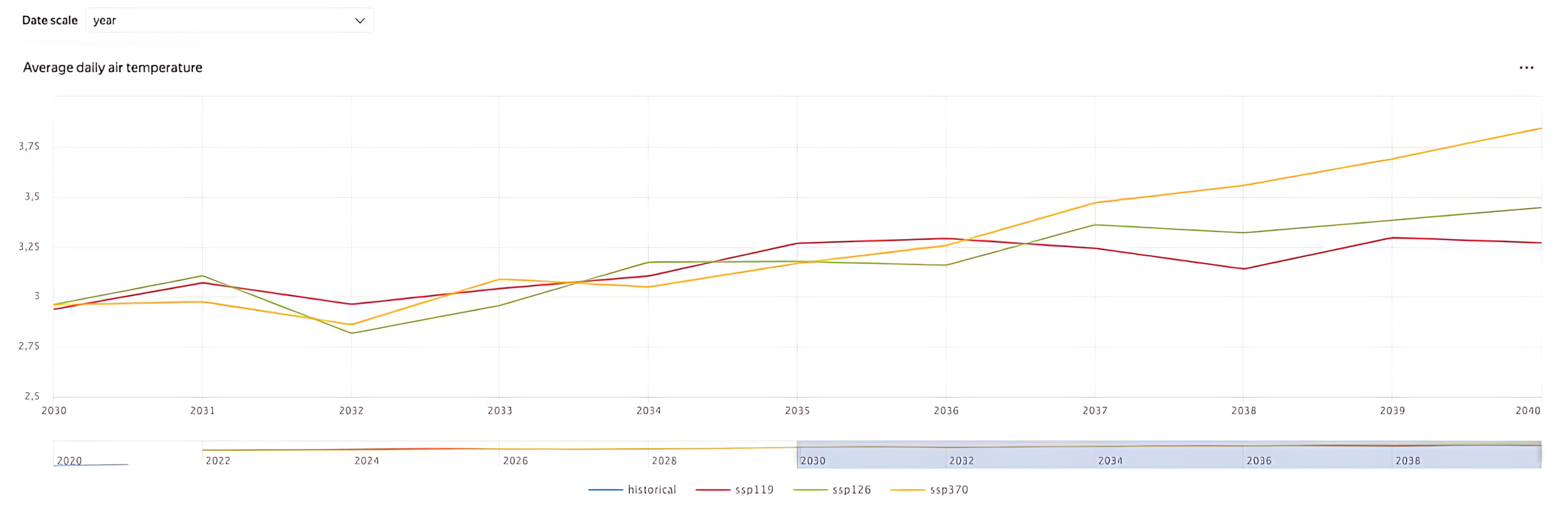
Our team picked and analyzed 10 key weather parameters from the CMIP-6 ensemble. Only the most relevant parameters were selected for analysis, such as the likelihood of flash flooding.
-
This data was used to create and describe 5 distinct climate projections that provide a comprehensive understanding of potential future conditions.
-
We also provided the client with 30 years of historical weather data to establish a baseline and provide context for the projections. The historical data set was chosen with quality, accuracy, and timeliness in mind.